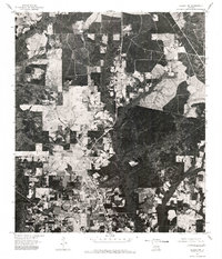
1976 Map of Folsom NW
USGS Topo · Published 1977About this map
Folsom occupies the southern edge of this mid-1970s orthophotoquad, which captures the transition between dense woodland and cleared agricultural tracts in St. Tammany Parish. Unlike traditional line-drawn maps, this aerial imagery provides a direct visual record of the land surface as it appeared in January 1976. The landscape is defined by a distinct patchwork of timber and farming, with narrow corridors of dense canopy following the natural drainage patterns that cut through the terrain. A clear diagonal road corridor facilitates movement through the northwest of the settlement, while large rectilinear clearings suggest active forestry or livestock operations common to this region of the Louisiana Florida Parishes. The resolution of the scan reveals the specific footprint of rural homesites and the density of the pine and hardwood forests characteristic of the area during this period of development.
Find a feature on this map
1 named feature on this map. Tap any name to fly to it.
Don’t see what you’re looking for? This feature index may not catch every label — zoom into the map to look around manually.
Map Details
Editions of this 1976 Folsom NW Map
This is the sole edition of this map. No revisions or reprints were ever made.
Other maps of this area

1939 · Zona
USGS Topo · 1:31,680

1942 · Onville
USGS Topo · 1:31,680

1942 · Waldheim
USGS Topo · 1:31,680

1942 · Husser
USGS Topo · 1:31,680

1942 · Robert
USGS Topo · 1:31,680

1942 · Thigpen
USGS Topo · 1:31,680

1942 · Wilmer
USGS Topo · 1:31,680

1950 · Folsom
USGS Topo · 1:31,680

1950 · Franklinton
USGS Topo · 1:31,680

1954 · Folsom
USGS Topo · 1:62,500