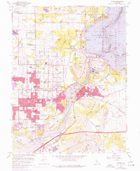
1967 Map of Folsom
USGS Topo · Published 1977About this map
The American River corridor during the mid-1970s is defined by massive water management projects and the outward expansion of suburban Orangevale and Roseville. Dominating the landscape is the Folsom Dam, which creates the expansive Folsom Lake and regulates the flow into the Lake Natoma Unit. A striking contrast exists between the modern developments and the historical scars of the mining era, visible in the extensive dredge tailings lining the riverbanks below Folsom.
Find a feature on this map
66 named features on this map. Tap any name to fly to it.
Don’t see what you’re looking for? This feature index may not catch every label — zoom into the map to look around manually.
Map Details
Editions of this 1967 Folsom Map
4 editions found
Other maps of this area

1891 · Sacramento
USGS Topo · 1:125,000

1892 · Sacramento
USGS Topo · 1:125,000

1893 · Sacramento
USGS Topo · 1:125,000

1902 · Fairoaks
USGS Topo · 1:62,500

1908 · Buffalo Creek
USGS Topo · 1:31,680

1910 · Roseville
USGS Topo · 1:31,680

1911 · Mills
USGS Topo · 1:31,680

1911 · Antelope
USGS Topo · 1:31,680

1914 · Folsom
USGS Topo · 1:31,680
1916 · Buffalo Creek
USGS Topo · 1:31,680