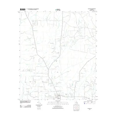
2012 Map of Folsom
USGS Topo · Published 2012About this map
Folsom serves as the primary hub in this northern St. Tammany Parish landscape, characterized by its dense network of family cemeteries and branching waterways. The village is well-defined by its local Po and the Folsom Village Wastewater Treatment Facility, with rural life radiating outward along routes like Lee Settlement Rd and Richardson Hill Rd. Genealogists will find a wealth of burial sites including the Hay Hollow Cem, Elias Lee Cem, and Poplus Cem, reflecting a deeply rooted community settlement pattern. The terrain is carved by the Tchefuncte River to the southwest and the multifaceted branches of the Bogue Falaya to the east. Landmarks such as the Unicorn Airport and Yates New Pond punctuate the wooded and residential plots that define the region's early 21st-century character.
Find a feature on this map
130 named features on this map. Tap any name to fly to it.
Don’t see what you’re looking for? This feature index may not catch every label — zoom into the map to look around manually.
Map Details
Editions of this 2012 Folsom Map
This is the sole edition of this map. No revisions or reprints were ever made.
Other maps of this area

1939 · Zona
USGS Topo · 1:31,680

1942 · Onville
USGS Topo · 1:31,680

1942 · Waldheim
USGS Topo · 1:31,680

1942 · Husser
USGS Topo · 1:31,680

1942 · Robert
USGS Topo · 1:31,680

1942 · Thigpen
USGS Topo · 1:31,680

1942 · Wilmer
USGS Topo · 1:31,680

1950 · Folsom
USGS Topo · 1:31,680

1950 · Franklinton
USGS Topo · 1:31,680

1954 · Folsom
USGS Topo · 1:62,500