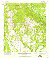
1958 Map of Folsom
USGS Topo · Published 1959About this map
The Bogue Chitto River and its numerous tributaries, including Thigpen Creek and Clearwater Br, carve through the piney woods and wetlands of St. Tammany and Washington Parishes. During the late 1950s, this landscape was defined by its spiritual and educational centers, from the St Gertrude Convent and St Benedict Chapel in the south to a network of rural schools like the Folsom Rosenwald Sch and Folsom Mission Sch.
Find a feature on this map
101 named features on this map. Tap any name to fly to it.
Don’t see what you’re looking for? This feature index may not catch every label — zoom into the map to look around manually.
Map Details
Editions of this 1958 Folsom Map
2 editions found
Other maps of this area

1935 · Slidell
USGS Topo · 1:62,500

1935 · Covington
USGS Topo · 1:62,500

1935 · Ponchatoula
USGS Topo · 1:62,500

1939 · Ponchatoula
USGS Topo · 1:62,500

1939 · Slidell
USGS Topo · 1:62,500

1939 · Zona
USGS Topo · 1:31,680

1939 · Covington
USGS Topo · 1:62,500

1942 · Onville
USGS Topo · 1:31,680

1942 · Waldheim
USGS Topo · 1:31,680

1942 · Husser
USGS Topo · 1:31,680