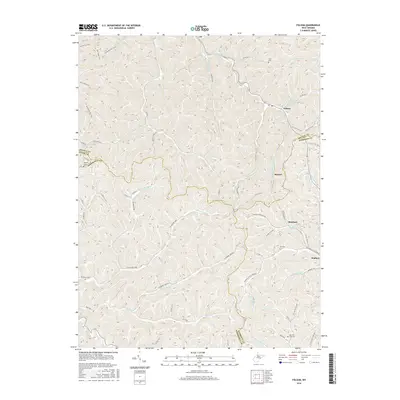
2016 Map of Folsom
USGS Topo · Published 2016About this map
The S Fork Fishing Cr and its complex network of tributaries, such as Talkington Fork and Beverlin Fork, define this West Virginia landscape at the junction of Wetzel, Harrison, Tyler, and Doddridge counties. In the village of Folsom, the convergence of Stout Run, Morgans Run, and Sams Run marks a central point of settlement. This 2016 survey documents the enduring layout of rural communities like Hartzel, Rinehart, and Wallace, connected by early routes including Old State Hwy 20. The high concentration of family and community burial grounds, such as Stout Cem, Morgan Cem, Dye Cem, and McIntyre Fork Cem, provides essential points of reference for genealogical research. The terrain is marked by prominent elevations like Beverlin Fork Hill and numerous named hollows, reflecting a topography deeply intertwined with the winding courses of Little Tenmile Cr and McIntyre Fork.
Find a feature on this map
68 named features on this map. Tap any name to fly to it.
Don’t see what you’re looking for? This feature index may not catch every label — zoom into the map to look around manually.
Map Details
Editions of this 2016 Folsom Map
This is the sole edition of this map. No revisions or reprints were ever made.
Other maps of this area

1902 · Clarksburg
USGS Topo · 1:62,500

1903 · Littleton
USGS Topo · 1:62,500

1905 · Mannington
USGS Topo · 1:62,500

1905 · Centerpoint
USGS Topo · 1:62,500

1905 · Littleton
USGS Topo · 1:62,500

1910 · Clarksburg
USGS Topo · 1:62,500

1923 · Mannington
USGS Topo · 1:62,500

1923 · Clarksburg
USGS Topo · 1:62,500

1924 · Centerpoint
USGS Topo · 1:62,500

1924 · Littleton
USGS Topo · 1:62,500