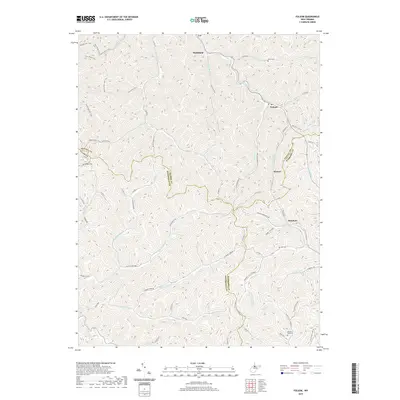
2019 Map of Folsom
USGS Topo · Published 2019About this map
Smithfield and Folsom anchor this interior view of West Virginia's rugged hill country, where the borders of Wetzel, Tyler, Doddridge, and Harrison counties converge. The landscape is defined by a dense network of watercourses and hollows, including the S Fork Fishing Cr and Arches Fork. Small settlements such as Hartzel and Rinehart are situated along these valley floors, connected by narrow winding routes like Old State HWY 20 and Little Tenmile RD. For genealogists, the map preserves the locations of family-named burial grounds like McIntire Fork Cem and Stout Cem, alongside markers of local geography such as Beverlin Fork Hill. The inclusion of various paths, including the Nettles Run Trail and Hart Ridge Trail, indicates the continuing importance of ridge-top access in this deeply dissected terrain.
Find a feature on this map
72 named features on this map. Tap any name to fly to it.
Don’t see what you’re looking for? This feature index may not catch every label — zoom into the map to look around manually.
Map Details
Editions of this 2019 Folsom Map
This is the sole edition of this map. No revisions or reprints were ever made.
Other maps of this area

1902 · Clarksburg
USGS Topo · 1:62,500

1903 · Littleton
USGS Topo · 1:62,500

1905 · Mannington
USGS Topo · 1:62,500

1905 · Centerpoint
USGS Topo · 1:62,500

1905 · Littleton
USGS Topo · 1:62,500

1910 · Clarksburg
USGS Topo · 1:62,500

1923 · Mannington
USGS Topo · 1:62,500

1923 · Clarksburg
USGS Topo · 1:62,500

1924 · Centerpoint
USGS Topo · 1:62,500

1924 · Littleton
USGS Topo · 1:62,500