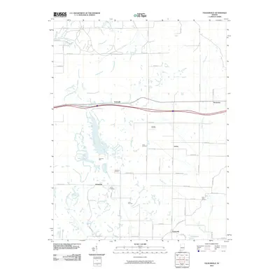
2010 Map of Folsomville
USGS Topo · Published 2010About this map
Folsomville and its surrounding agricultural and mining landscape are documented in this detailed 2010 survey. The geography is defined by a dense network of country roads and the winding paths of the South Fork Patoka River and Coles Creek. Significant industrial history is evident at the Tecumseh Mine, which sits west of Jockey. The map is particularly valuable for genealogical research, identifying numerous local burial grounds including Shiloh Cemetery, Ebenezer Cemetery, and the Barrenfork Cemetery. Small rural intersections and settlements such as Scalesville, Hemenway, and Dickeyville are clearly marked, showing the persistent settlement patterns of Warrick County. Natural drainage is shaped by Barren Fork and Brushy Fork, which lead toward Hendrickson Lake in the south, illustrating the intricate hydrology that supports the region's farms and timber tracts.
Find a feature on this map
46 named features on this map. Tap any name to fly to it.
Don’t see what you’re looking for? This feature index may not catch every label — zoom into the map to look around manually.
Map Details
Editions of this 2010 Folsomville Map
This is the sole edition of this map. No revisions or reprints were ever made.
Other maps of this area

1900 · De Gonia Springs
USGS Topo · 1:62,500

1902 · Ditney
USGS Topo · 1:125,000

1902 · Degonia Springs
USGS Topo · 1:62,500

1902 · Boonville
USGS Topo · 1:62,500

1903 · Velpen
USGS Topo · 1:62,500

1903 · Petersburg
USGS Topo · 1:62,500

1956 · Vincennes
USGS Topo · 1:250,000

1957 · Vincennes
USGS Topo · 1:250,000

1958 · Vincennes
USGS Topo · 1:250,000
1960 · De Gonia Springs
USGS Topo · 1:24,000