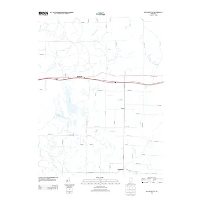
2013 Map of Folsomville
USGS Topo · Published 2013About this map
Folsomville anchors the southern portion of this landscape, a region defined by the winding tributaries of the S Fork Patoka River and the rural crossroads of Warrick County. The map documents a patchwork of small communities, including Scalesville, Dickeyville, and Jockey, connected by a network of county roads that follow the natural drainage patterns of Barren Fork and Brushy Fork. Evidence of the area’s agricultural and social fabric is found in local landmarks like Gentry Cemetery Rd and Rice School Rd, while the northern reaches show industrial adaptation through the presence of a Haul Rd. Near the eastern boundary, Hemenway sits along the upper reaches of Coles Cr, showing how settlement once clung to these small watercourses before modern highways shifted the local focus.
Find a feature on this map
62 named features on this map. Tap any name to fly to it.
Don’t see what you’re looking for? This feature index may not catch every label — zoom into the map to look around manually.
Map Details
Editions of this 2013 Folsomville Map
This is the sole edition of this map. No revisions or reprints were ever made.
Other maps of this area

1900 · De Gonia Springs
USGS Topo · 1:62,500

1902 · Ditney
USGS Topo · 1:125,000

1902 · Degonia Springs
USGS Topo · 1:62,500

1902 · Boonville
USGS Topo · 1:62,500

1903 · Velpen
USGS Topo · 1:62,500

1903 · Petersburg
USGS Topo · 1:62,500

1956 · Vincennes
USGS Topo · 1:250,000

1957 · Vincennes
USGS Topo · 1:250,000

1958 · Vincennes
USGS Topo · 1:250,000
1960 · De Gonia Springs
USGS Topo · 1:24,000