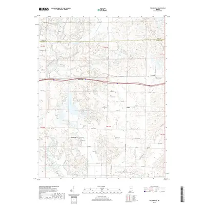
2019 Map of Folsomville
USGS Topo · Published 2019About this map
The small communities of Folsomville and Scalesville anchor this southern Indiana landscape where the rolling terrain of Warrick and Pike counties meets. For genealogists, the map is particularly detailed, locating family-named landmarks and several burying grounds including Ashby - McClary Cem, Shiloh Cem, and Hull Cem. The region's drainage pattern is defined by the S Fork Patoka River in the north and the Barren Fork running through the center, feeding into Hendrickson Lake near the southern boundary. A network of rural roads and specialized paths like Multi-Use Trails and Single Track / Equestrian Trails cross the wooded ridges, reflecting a transition from traditional agriculture to modern recreational use. The inclusion of a Haul Rd in the northeast suggests the ongoing influence of the regional extraction economy alongside established settlements like Dickeyville and Jockey.
Find a feature on this map
71 named features on this map. Tap any name to fly to it.
Don’t see what you’re looking for? This feature index may not catch every label — zoom into the map to look around manually.
Map Details
Editions of this 2019 Folsomville Map
This is the sole edition of this map. No revisions or reprints were ever made.
Other maps of this area

1900 · De Gonia Springs
USGS Topo · 1:62,500

1902 · Ditney
USGS Topo · 1:125,000

1902 · Degonia Springs
USGS Topo · 1:62,500

1902 · Boonville
USGS Topo · 1:62,500

1903 · Velpen
USGS Topo · 1:62,500

1903 · Petersburg
USGS Topo · 1:62,500

1956 · Vincennes
USGS Topo · 1:250,000

1957 · Vincennes
USGS Topo · 1:250,000

1958 · Vincennes
USGS Topo · 1:250,000
1960 · De Gonia Springs
USGS Topo · 1:24,000