
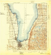
1910 Map of Fond du Lac
USGS Topo · Published 1910About this map
Lake Winnebago dominates the landscape of this 1908 survey, with the city of Fond du Lac established as a major regional hub at its southern tip. The map reveals a dense network of industrial and transport infrastructure, including the Minneapolis St Paul and Sault Ste Marie RR and the Chicago and Northwestern Ry, which converged on the rail yards of North Fond du Lac.
Find a feature on this map
62 named features on this map. Tap any name to fly to it.
Don’t see what you’re looking for? This feature index may not catch every label — zoom into the map to look around manually.
Map Details
Editions of this 1910 Fond du Lac Map
2 editions found
Other maps of this area

1911 · Neenah
USGS Topo · 1:62,500

1954 · Chilton
USGS Topo · 1:62,500

1954 · Kiel
USGS Topo · 1:62,500

1955 · Neenah
USGS Topo · 1:62,500

1955 · Waupun
USGS Topo · 1:62,500

1955 · Campbellsport
USGS Topo · 1:62,500

1955 · Kewaskum
USGS Topo · 1:62,500

1955 · Fond Du Lac
USGS Topo · 1:62,500

1955 · Fond Du Lac
USGS Topo · 1:24,000

1955 · Green Bay
USGS Topo · 1:250,000