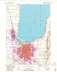
1955 Map of Fond Du Lac
USGS Topo · Published 1985About this map
Lake Winnebago dominates the northern half of this landscape, its southern shoreline defining the urban and industrial layout of Fond du Lac and North Fond du Lac. The mid-1950s infrastructure is captured in detail, showing a dense network of educational and religious institutions including Marian College, Winnebago Academy, and Mt Marys Springs Academy. The rail-centric character of the era is evident through the extensive facilities of the Chicago and North Western and Soo Line, which converge near the Supple Marsh and the East Branch Fond du Lac River.
Find a feature on this map
68 named features on this map. Tap any name to fly to it.
Don’t see what you’re looking for? This feature index may not catch every label — zoom into the map to look around manually.
Map Details
Editions of this 1955 Fond Du Lac Map
2 editions found
Other maps of this area

1910 · Fond du Lac
USGS Topo · 1:62,500

1955 · Waupun
USGS Topo · 1:62,500

1955 · Campbellsport
USGS Topo · 1:62,500

1955 · Fond Du Lac
USGS Topo · 1:62,500

1955 · Fond Du Lac
USGS Topo · 1:24,000

1956 · Rosendale
USGS Topo · 1:62,500

1957 · Madison
USGS Topo · 1:250,000

1960 · Madison
USGS Topo · 1:250,000
1974 · St. Peter
USGS Topo · 1:24,000
1974 · Fahrney Point
USGS Topo · 1:24,000