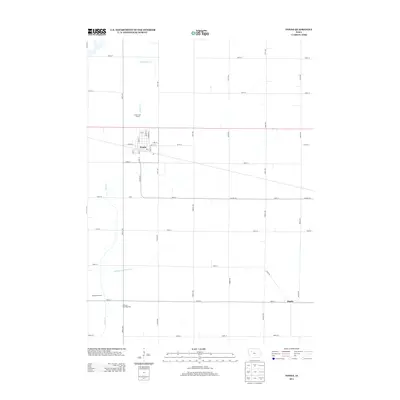
2013 Map of Fonda
USGS Topo · Published 2013About this map
Fonda stands as the primary hub of this northwestern Iowa landscape, where a grid of streets like Main St and Bridge St meets the rail line at the town's center. The surrounding rural terrain is defined by the agricultural geometry of Pocahontas County, etched with an extensive network of section roads such as 140th Ave and Co Hwy-D11. Waterways like Cedar Cr and Little Cedar Cr wind through the fields, eventually managed by engineered systems like Drainage Ditch Number 37. To the south, the small community of Knoke sits along the roadway, while landmarks like Williams Township Hall and the Kelly Access Area provide specific points of interest for local history and public use. This survey captures the region's managed hydrology and its established rural infrastructure in the early 21st century.
Find a feature on this map
46 named features on this map. Tap any name to fly to it.
Don’t see what you’re looking for? This feature index may not catch every label — zoom into the map to look around manually.
Map Details
Editions of this 2013 Fonda Map
This is the sole edition of this map. No revisions or reprints were ever made.
Other maps of this area

1954 · Fort Dodge
USGS Topo · 1:250,000

1957 · Fort Dodge
USGS Topo · 1:250,000

1958 · Fort Dodge
USGS Topo · 1:250,000

1979 · Pocahontas
USGS Topo · 1:24,000

1979 · Varina
USGS Topo · 1:24,000

1979 · Fonda
USGS Topo · 1:24,000

1979 · Pomeroy
USGS Topo · 1:24,000

1979 · Newell East
USGS Topo · 1:24,000

1979 · Fonda NE
USGS Topo · 1:24,000

1980 · Lytton
USGS Topo · 1:24,000