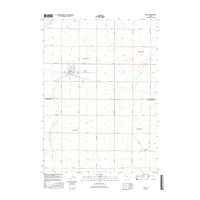
2015 Map of Fonda
USGS Topo · Published 2015About this map
Fonda serves as the primary hub of this Iowa prairie landscape, its grid defined by streets like Bridge St and Howard St. The town is situated just north of the border between Pocahontas Co and Calhoun Co, a division that marks the transition into the southern agricultural reaches of the region. To the southeast, the small settlement of Knoke sits along Knoke Rd, while the surrounding terrain is etched by the meandering courses of Cedar Creek and Little Cedar Cr. This 2015 survey reveals an environment where natural waterways and human engineering coexist, notably seen in Drainage Ditch Number 37, which manages the level fields. For genealogists, the map provides precise locations for local resting places, including Cedar Cem and Zion Cem, both located just east of the main Fonda townsite.
Find a feature on this map
45 named features on this map. Tap any name to fly to it.
Don’t see what you’re looking for? This feature index may not catch every label — zoom into the map to look around manually.
Map Details
Editions of this 2015 Fonda Map
This is the sole edition of this map. No revisions or reprints were ever made.
Other maps of this area

1954 · Fort Dodge
USGS Topo · 1:250,000

1957 · Fort Dodge
USGS Topo · 1:250,000

1958 · Fort Dodge
USGS Topo · 1:250,000

1979 · Pocahontas
USGS Topo · 1:24,000

1979 · Varina
USGS Topo · 1:24,000

1979 · Fonda
USGS Topo · 1:24,000

1979 · Pomeroy
USGS Topo · 1:24,000

1979 · Newell East
USGS Topo · 1:24,000

1979 · Fonda NE
USGS Topo · 1:24,000

1980 · Lytton
USGS Topo · 1:24,000