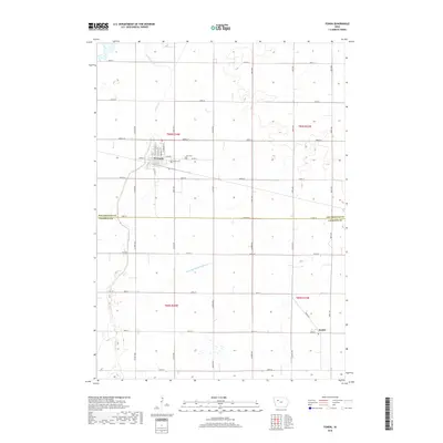
2018 Map of Fonda
USGS Topo · Published 2018About this map
Fonda sits at the intersection of local routes and the rural landscape along the border of Pocahontas and Calhoun Counties. This agricultural region is defined by a dense grid of section roads and the meandering path of Cedar Creek, which flows through the western portion of the quadrangle. The town of Fonda displays a detailed street plan including N Franklin St and Fairburn St, serving as a central hub for the surrounding farmsteads. To the southeast, the small settlement of Knoke marks a quieter corner of the county near Knoke Rd. The landscape reflects Iowa's managed hydrology, prominently featuring the engineered Drainage Ditch Number 37 alongside natural waterways. Genealogists will find the locations of Zion Cem and Cedar Cem essential for tracing local family history in this prairie community.
Find a feature on this map
42 named features on this map. Tap any name to fly to it.
Don’t see what you’re looking for? This feature index may not catch every label — zoom into the map to look around manually.
Map Details
Editions of this 2018 Fonda Map
This is the sole edition of this map. No revisions or reprints were ever made.
Other maps of this area

1954 · Fort Dodge
USGS Topo · 1:250,000

1957 · Fort Dodge
USGS Topo · 1:250,000

1958 · Fort Dodge
USGS Topo · 1:250,000

1979 · Pocahontas
USGS Topo · 1:24,000

1979 · Varina
USGS Topo · 1:24,000

1979 · Fonda
USGS Topo · 1:24,000

1979 · Pomeroy
USGS Topo · 1:24,000

1979 · Newell East
USGS Topo · 1:24,000

1979 · Fonda NE
USGS Topo · 1:24,000

1980 · Lytton
USGS Topo · 1:24,000