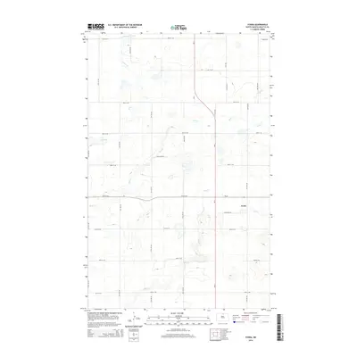
2014 Map of Fonda
USGS Topo · Published 2014About this map
Fonda occupies a central position within this Rolette County landscape, situated at the intersection of ND-66 and ND-3. The terrain is characterized by a complex drainage network typical of the northern plains, where several watercourses meander through the prairie. To the north and west, Willow Cr and Mud Cr wind across the section lines, while Snake Cr and Wolf Cr drain the eastern and southern portions of the quadrangle. The map illustrates a rigid section-line road grid, including Dahlen Dr NE and Stella Ave NE, which segments the land into a patchwork of rural holdings. This layout reflects the late-period agricultural organization of North Dakota, where the placement of small communities like Fonda was historically tied to the reach of regional transit routes and local water sources.
Find a feature on this map
26 named features on this map. Tap any name to fly to it.
Don’t see what you’re looking for? This feature index may not catch every label — zoom into the map to look around manually.
Map Details
Editions of this 2014 Fonda Map
This is the sole edition of this map. No revisions or reprints were ever made.
Other maps of this area

1935 · Dunseith
USGS Topo · 1:48,000

1936 · Lake Upsilon
USGS Topo · 1:48,000

1939 · Dunseith
USGS Topo · 1:62,500

1942 · Lake Upsilon
USGS Topo · 1:62,500

1953 · Devils Lake
USGS Topo · 1:250,000

1954 · Overly SE
USGS Topo · 1:24,000

1954 · Barton
USGS Topo · 1:24,000

1954 · Minot
USGS Topo · 1:250,000

1955 · Fonda
USGS Topo · 1:24,000

1955 · Thorne
USGS Topo · 1:24,000