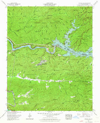
1961 Map of Fontana Dam
USGS Topo · Published 1964About this map
Fontana Village serves as the primary hub on this 1961 survey, situated at the intersection of the Great Smoky Mountains National Park and the Nantahala National Forest. The landscape is dominated by the reservoir's fingers reaching into deep valleys, reflecting the post-dam topography of Graham and Swain counties. Near the northern shore, the former settlement of Proctor is visible, along with its associated Proctor Field Gap Cem, providing a window into the communities that existed before the area's massive hydroelectric transformation.
Find a feature on this map
115 named features on this map. Tap any name to fly to it.
Don’t see what you’re looking for? This feature index may not catch every label — zoom into the map to look around manually.
Map Details
Editions of this 1961 Fontana Dam Map
4 editions found
Other maps of this area

1886 · Knoxville
USGS Topo · 1:125,000

1892 · Knoxville
USGS Topo · 1:125,000

1894 · Knoxville
USGS Topo · 1:125,000

1895 · Knoxville
USGS Topo · 1:125,000

1901 · Knoxville
USGS Topo · 1:125,000

1933 · Bushnell
USGS Topo · 1:62,500

1935 · Robbinsville
USGS Topo · 1:24,000

1935 · Fontana
USGS Topo · 1:24,000

1935 · Calderwood
USGS Topo · 1:24,000

1935 · Santeetlah Creek
USGS Topo · 1:24,000