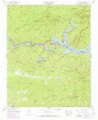
1961 Map of Fontana Dam
USGS Topo · Published 1978About this map
Fontana Dam stands as the central engineering feat along the Little Tennessee River, creating the expansive waters of Fontana Lake that separate the Great Smoky Mountains National Park from the Nantahala National Forest. This 1961 survey, updated with 1970s revisions, illustrates the established mountain community of Fontana Village and the remote settlement at Proctor. The Appalachian Trail winds through the northern ridges, passing landmarks like Shuckstack and the Fontana Copper Mine.
Find a feature on this map
97 named features on this map. Tap any name to fly to it.
Don’t see what you’re looking for? This feature index may not catch every label — zoom into the map to look around manually.
Map Details
Editions of this 1961 Fontana Dam Map
4 editions found
Other maps of this area

1886 · Knoxville
USGS Topo · 1:125,000

1892 · Knoxville
USGS Topo · 1:125,000

1894 · Knoxville
USGS Topo · 1:125,000

1895 · Knoxville
USGS Topo · 1:125,000

1901 · Knoxville
USGS Topo · 1:125,000

1933 · Bushnell
USGS Topo · 1:62,500

1935 · Robbinsville
USGS Topo · 1:24,000

1935 · Fontana
USGS Topo · 1:24,000

1935 · Calderwood
USGS Topo · 1:24,000

1935 · Santeetlah Creek
USGS Topo · 1:24,000