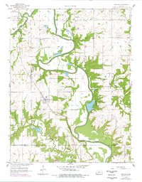
1958 Map of Fontana
USGS Topo · Published 1978About this map
The town of Fontana serves as the central hub of this eastern Kansas landscape, situated where the St Louis San Francisco railroad cuts through the countryside. The geography is dominated by the winding course of the Marais Des Cygnes River, which is flanked by an extensive Levee system and a notable Spoil Bank near Miami County State Park. These engineering features highlight the historical efforts to manage the river's floodwaters for the surrounding agricultural valley.
Find a feature on this map
27 named features on this map. Tap any name to fly to it.
Don’t see what you’re looking for? This feature index may not catch every label — zoom into the map to look around manually.
Map Details
Editions of this 1958 Fontana Map
2 editions found
Other maps of this area

1887 · Olathe
USGS Topo · 1:125,000

1887 · Mound City
USGS Topo · 1:125,000

1893 · Mound City
USGS Topo · 1:125,000

1893 · Olathe
USGS Topo · 1:125,000

1947 · Lawrence
USGS Topo · 1:250,000

1950 · Lawrence
USGS Topo · 1:250,000

1956 · Paola East
USGS Topo · 1:24,000

1956 · Lawrence
USGS Topo · 1:250,000
1957 · Paola West
USGS Topo · 1:24,000
1957 · Louisburg
USGS Topo · 1:24,000