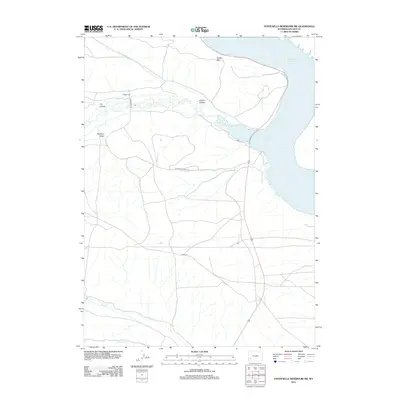
2012 Map of Fontenelle Reservoir SW
USGS Topo · Published 2012About this map
Holden Cem and nearby Holden Hill anchor the landscape north of the winding Fontenelle Cr. This portion of Lincoln County is defined by the significant shoreline of the Fontenelle Reservoir, which dominates the eastern edge of the map. The terrain consists of distinct drainages and elevations, including Holden Hollow, Dry Hollow, and Pomeroy Draw. Transportation in this rural stretch of Wyoming is primarily facilitated by unpaved routes such as Diamond H Rd, Fontenelle Creek Rd, and Co Rd 313. Several seasonal waterways, including Sheep Cr and Jackson Cr, traverse the high desert plains toward the reservoir, illustrating the typical drainage patterns of the Green River Basin before the modern era of water management.
Find a feature on this map
12 named features on this map. Tap any name to fly to it.
Don’t see what you’re looking for? This feature index may not catch every label — zoom into the map to look around manually.
Map Details
Editions of this 2012 Fontenelle Reservoir SW Map
This is the sole edition of this map. No revisions or reprints were ever made.
Other maps of this area

1945 · Fort Hill
USGS Topo · 1:62,500

1947 · Fort Hill
USGS Topo · 1:62,500

1954 · Ogden
USGS Topo · 1:250,000

1955 · Preston
USGS Topo · 1:250,000

1958 · Ogden
USGS Topo · 1:250,000

1958 · Preston
USGS Topo · 1:250,000

1960 · Ogden
USGS Topo · 1:250,000

1962 · Preston
USGS Topo · 1:250,000

1968 · Anderson Canyon
USGS Topo · 1:24,000

1968 · Fontenelle Reservoir SE
USGS Topo · 1:24,000