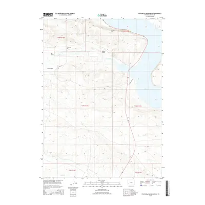
2015 Map of Fontenelle Reservoir SW
USGS Topo · Published 2015About this map
Fontenelle Reservoir dominates the eastern edge of this high-desert landscape in Lincoln County, where the Green River valley was transformed by mid-century water management. The topography is defined by significant draws and hollows that drain toward the reservoir, including the namesake Fontenelle Cr, Sheep Cr, and Jackson Cr. For those researching local history, the map identifies Holden Cem situated near the intersection of the high plains and the breaking slopes of Holden Hill. The distribution of rural routes like Diamond H Rd and Fontenelle Creek Rd illustrates a ranching and land-management network that persists across this arid terrain. Notable geographical features such as Pomeroy Draw and Dry Hollow reflect the seasonal hydrology and erosion patterns of the western Wyoming basin.
Find a feature on this map
19 named features on this map. Tap any name to fly to it.
Don’t see what you’re looking for? This feature index may not catch every label — zoom into the map to look around manually.
Map Details
Editions of this 2015 Fontenelle Reservoir SW Map
This is the sole edition of this map. No revisions or reprints were ever made.
Other maps of this area

1945 · Fort Hill
USGS Topo · 1:62,500

1947 · Fort Hill
USGS Topo · 1:62,500

1954 · Ogden
USGS Topo · 1:250,000

1955 · Preston
USGS Topo · 1:250,000

1958 · Ogden
USGS Topo · 1:250,000

1958 · Preston
USGS Topo · 1:250,000

1960 · Ogden
USGS Topo · 1:250,000

1962 · Preston
USGS Topo · 1:250,000

1968 · Anderson Canyon
USGS Topo · 1:24,000

1968 · Fontenelle Reservoir SE
USGS Topo · 1:24,000