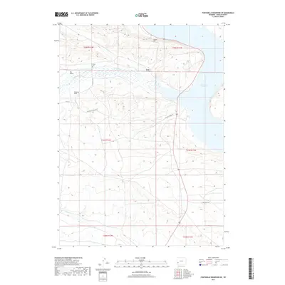
2017 Map of Fontenelle Reservoir SW
USGS Topo · Published 2017About this map
Holden Cem sits atop the high ground overlooking the confluence where Fontenelle Cr meets the upper reaches of the Fontenelle Reservoir. This 2017 survey by the U.S. Geological Survey captures a landscape defined by water management and high-desert topography in Lincoln County. The southern expanse of the reservoir is anchored by the Fontenelle Dam, a significant piece of local infrastructure that transformed the natural flow of the Green River valley.
Find a feature on this map
19 named features on this map. Tap any name to fly to it.
Don’t see what you’re looking for? This feature index may not catch every label — zoom into the map to look around manually.
Map Details
Editions of this 2017 Fontenelle Reservoir SW Map
This is the sole edition of this map. No revisions or reprints were ever made.
Other maps of this area

1945 · Fort Hill
USGS Topo · 1:62,500

1947 · Fort Hill
USGS Topo · 1:62,500

1954 · Ogden
USGS Topo · 1:250,000

1955 · Preston
USGS Topo · 1:250,000

1958 · Ogden
USGS Topo · 1:250,000

1958 · Preston
USGS Topo · 1:250,000

1960 · Ogden
USGS Topo · 1:250,000

1962 · Preston
USGS Topo · 1:250,000

1968 · Anderson Canyon
USGS Topo · 1:24,000

1968 · Fontenelle Reservoir SE
USGS Topo · 1:24,000