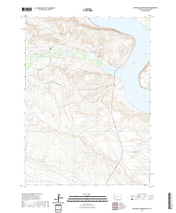
2021 Map of Fontenelle Reservoir SW
USGS Topo · Published 2021About this map
The Fontenelle Dam anchors the southeastern edge of this landscape, holding the southern reaches of the Fontenelle Reservoir. The terrain here is defined by a series of drainage systems and high points, most notably Holden Hill and the adjacent Holden Hollow to the north. A significant cultural landmark is found in the Holden Cem, situated on a ridge overlooking the bottomlands near Fontenelle Cr. This cemetery, along with the family-named features like Pomeroy Draw, points to the early ranching and homesteading history of the area before the modern reservoir altered the local hydrography. Improved surfaces such as Diamond H Rd and Fontenelle Creek Rd provide access through the complex topography of the high desert plateau, connecting various draws and seasonal creeks like Sheep Cr and Jackson Cr.
Find a feature on this map
20 named features on this map. Tap any name to fly to it.
Don’t see what you’re looking for? This feature index may not catch every label — zoom into the map to look around manually.
Map Details
Editions of this 2021 Fontenelle Reservoir SW Map
This is the sole edition of this map. No revisions or reprints were ever made.
Other maps of this area

1945 · Fort Hill
USGS Topo · 1:62,500

1947 · Fort Hill
USGS Topo · 1:62,500

1954 · Ogden
USGS Topo · 1:250,000

1955 · Preston
USGS Topo · 1:250,000

1958 · Ogden
USGS Topo · 1:250,000

1958 · Preston
USGS Topo · 1:250,000

1960 · Ogden
USGS Topo · 1:250,000

1962 · Preston
USGS Topo · 1:250,000

1968 · Anderson Canyon
USGS Topo · 1:24,000

1968 · Fontenelle Reservoir SE
USGS Topo · 1:24,000