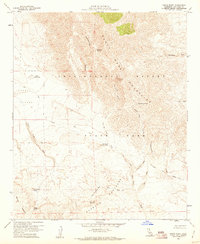
1959 Map of Fonts Point
USGS Topo · Published 1961About this map
Anza-Borrego Desert State Park reveals a complex landscape of arid basins and high peaks as surveyed at the end of the 1950s. The topography is defined by the sharp transition between the Santa Rosa Mountains and the intricate erosion of the Borrego Badlands. Human activity in this desert environment is marked by essential water sources like Rattlesnake Spring and Palo Verde Spring, alongside the isolated Palo Verde Ranger Station.
Find a feature on this map
29 named features on this map. Tap any name to fly to it.
Don’t see what you’re looking for? This feature index may not catch every label — zoom into the map to look around manually.
Map Details
Editions of this 1959 Fonts Point Map
4 editions found
Other maps of this area

1904 · Indio
USGS Topo · 1:125,000

1931 · Vallecito
USGS Topo · 1:125,000

1939 · Borrego
USGS Topo · 1:62,500

1941 · Clark Lake
USGS Topo · 1:62,500

1942 · Barrel Spring
USGS Topo · 1:62,500

1942 · Agua Dulce
USGS Topo · 1:62,500

1942 · Clark Lake
USGS Topo · 1:62,500

1942 · Borego
USGS Topo · 1:62,500

1943 · Vallecito
USGS Topo · 1:125,000

1944 · Agua Dulce
USGS Topo · 1:62,500