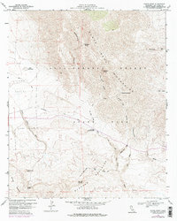
1959 Map of Fonts Point
USGS Topo · Published 1977About this map
Anza-Borrego Desert State Park encompasses this arid landscape, where the Santa Rosa Mountains drop into the deeply eroded topography of the Borrego Badlands. The map illustrates the specialized transport networks of the mid-20th century desert, including the Truckhaven Trail and numerous jeep trails that follow natural drainage patterns like Palo Verde Wash and Smoke Tree Wash. Settlement is almost non-existent, represented primarily by the Palo Verde Ranger Station and remote water sources such as Rattlesnake Spring and Natural Rock Tanks. Landmarks like Fonts Point and Inspiration Point offer expansive views over the Badlands, while a lone Prospect in Smoke Tree Canyon suggests the era's lingering interest in mineral exploration within the rugged Clark Valley region.
Find a feature on this map
30 named features on this map. Tap any name to fly to it.
Don’t see what you’re looking for? This feature index may not catch every label — zoom into the map to look around manually.
Map Details
Editions of this 1959 Fonts Point Map
4 editions found
Other maps of this area

1904 · Indio
USGS Topo · 1:125,000

1931 · Vallecito
USGS Topo · 1:125,000

1939 · Borrego
USGS Topo · 1:62,500

1941 · Clark Lake
USGS Topo · 1:62,500

1942 · Barrel Spring
USGS Topo · 1:62,500

1942 · Agua Dulce
USGS Topo · 1:62,500

1942 · Clark Lake
USGS Topo · 1:62,500

1942 · Borego
USGS Topo · 1:62,500

1943 · Vallecito
USGS Topo · 1:125,000

1944 · Agua Dulce
USGS Topo · 1:62,500