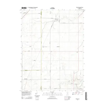
2015 Map of Foosland
USGS Topo · Published 2015About this map
Foosland sits at the intersection of the central Illinois prairie and several converging county lines, marking a landscape defined by its agricultural grid and the winding course of the Sangamon River. This 2015 U.S. Geological Survey representation documents the complex boundary junctions where McLean, Piatt, and Champaign counties meet. Historically significant sites for genealogists include Naylor Cem and Shiloh Cem, which remain as fixed points amidst the expansive farm roads. Smaller settlements and named locales like Lotus, Blue Ridge, and Osman dot the region, connected by a network of rural routes such as Co Road 100 E and CR-10. Waterways like Lone Tree Cr and Owl Cr provide the only breaks in the geometric regularity of the section lines, illustrating how drainage patterns shaped the early development of these farming communities.
Find a feature on this map
41 named features on this map. Tap any name to fly to it.
Don’t see what you’re looking for? This feature index may not catch every label — zoom into the map to look around manually.
Map Details
Editions of this 2015 Foosland Map
This is the sole edition of this map. No revisions or reprints were ever made.
Other maps of this area

1907 · Mahomet
USGS Topo · 1:62,500

1928 · Gibson City
USGS Topo · 1:62,500

1937 · Monticello
USGS Topo · 1:48,000

1943 · Monticello
USGS Topo · 1:62,500

1952 · Arrowsmith
USGS Topo · 1:62,500

1957 · Gibson City
USGS Topo · 1:62,500

1957 · Rising
USGS Topo · 1:24,000

1957 · Mahomet
USGS Topo · 1:62,500

1958 · Peoria
USGS Topo · 1:250,000

1961 · Peoria
USGS Topo · 1:250,000