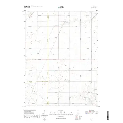
2021 Map of Foosland
USGS Topo · Published 2021About this map
Foosland and its surrounding rural prairie sits at the intersection of several central Illinois counties, where a network of gravel and paved section-line roads connects isolated agricultural settlements. The landscape is defined by the headwaters of the Sangamon River in the south and the winding course of Lone Tree Cr to the north. Small clusters of homes and grain facilities mark locales such as Lotus, Osman, and Blue Ridge, reflecting a long-standing pattern of dispersed farming communities. This modern survey by the U.S. Geological Survey captures the precise boundaries between McLean, Champaign, and Piatt counties. Genealogists and local historians can pinpoint family sites near rural landmarks like Naylor Cem or Shiloh Cem, which remain as quiet indicators of the area's early settlement history amidst the productive fields of the Grand Prairie.
Find a feature on this map
38 named features on this map. Tap any name to fly to it.
Don’t see what you’re looking for? This feature index may not catch every label — zoom into the map to look around manually.
Map Details
Editions of this 2021 Foosland Map
This is the sole edition of this map. No revisions or reprints were ever made.
Other maps of this area

1907 · Mahomet
USGS Topo · 1:62,500

1928 · Gibson City
USGS Topo · 1:62,500

1937 · Monticello
USGS Topo · 1:48,000

1943 · Monticello
USGS Topo · 1:62,500

1952 · Arrowsmith
USGS Topo · 1:62,500

1957 · Gibson City
USGS Topo · 1:62,500

1957 · Rising
USGS Topo · 1:24,000

1957 · Mahomet
USGS Topo · 1:62,500

1958 · Peoria
USGS Topo · 1:250,000

1961 · Peoria
USGS Topo · 1:250,000