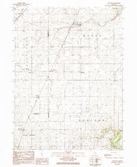
1984 Map of Foosland
USGS Topo · Published 1985About this map
Foosland and the surrounding agricultural prairies are defined by the convergence of major rail corridors and the headwaters of the Sangamon River in the early 1980s. This survey area straddles the borders of Champaign, McLean, and Piatt counties, documenting small grain-elevator settlements like Lotus, Osman, and Troster that grew along the Illinois Central Gulf and Norfolk and Western lines. The landscape is notably occupied by the extensive Manlove Gas Storage Area, an industrial footprint contrasting with the surrounding Brown and Blue Ridge townships.
Find a feature on this map
24 named features on this map. Tap any name to fly to it.
Don’t see what you’re looking for? This feature index may not catch every label — zoom into the map to look around manually.
Map Details
Editions of this 1984 Foosland Map
This is the sole edition of this map. No revisions or reprints were ever made.
Other maps of this area

1907 · Mahomet
USGS Topo · 1:62,500

1928 · Gibson City
USGS Topo · 1:62,500

1937 · Monticello
USGS Topo · 1:48,000

1943 · Monticello
USGS Topo · 1:62,500

1952 · Arrowsmith
USGS Topo · 1:62,500

1957 · Gibson City
USGS Topo · 1:62,500

1957 · Rising
USGS Topo · 1:24,000

1957 · Mahomet
USGS Topo · 1:62,500

1958 · Peoria
USGS Topo · 1:250,000

1961 · Peoria
USGS Topo · 1:250,000