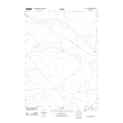
2012 Map of Foote Creek Lake
USGS Topo · Published 2012About this map
Foote Creek Lake sits at the center of this Wyoming drainage basin, where a network of seasonal and perennial waterways defines the high plains landscape. The hydrology of the region is dominated by Foote Cr, which winds extensively across the terrain, supported by man-made infrastructure like the Thornton Ditch in the southwest. This area, marked by subtle but significant topographical shifts, includes the elevated Iron Hill and the prominent Foote Creek Rim to the southeast. The map reveals a sparsely settled ranching or resource landscape, where water security is managed through isolated catchments such as Iron Hill Lake and Thornton Lake. While primarily open ground, the presence of Marshall Rd provides a primary transit corridor through this section of Albany County.
Find a feature on this map
8 named features on this map. Tap any name to fly to it.
Don’t see what you’re looking for? This feature index may not catch every label — zoom into the map to look around manually.
Map Details
Editions of this 2012 Foote Creek Lake Map
This is the sole edition of this map. No revisions or reprints were ever made.
Other maps of this area

1915 · Como Ridge
USGS Topo · 1:48,000

1918 · Como Ridge
USGS Topo · 1:62,500

1954 · Cheyenne
USGS Topo · 1:250,000

1954 · Rawlins
USGS Topo · 1:250,000

1955 · Pine Tree Ridge
USGS Topo · 1:24,000

1955 · Rock River
USGS Topo · 1:24,000

1955 · Wilcox
USGS Topo · 1:24,000

1958 · Rawlins
USGS Topo · 1:250,000

1958 · Cheyenne
USGS Topo · 1:250,000

1958 · Mc Fadden
USGS Topo · 1:24,000