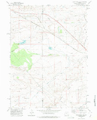
1971 Map of Foote Creek Lake
USGS Topo · Published 1975About this map
Foote Creek Lake sits at the heart of this high-plains landscape, where the boundary between Carbon and Albany counties cuts through a terrain defined by water management and transit. In the early 1970s, the area's geography was largely shaped by the Union Pacific and the abandoned Union Pacific Railroad Grade, which trace the path of the original transcontinental rail corridor. The presence of Iron Hill Lake and Thornton Lake, alongside man-made features like the Ditch and Pipeline, illustrate the constant effort to manage water in this arid environment. Significant landmarks like Iron Hill and the prominent Rim provide natural orientation points for those tracing the historic layout of the Rock River Marshall Road and the local communication hubs marked by a Radio Facility and Radio Tower.
Find a feature on this map
15 named features on this map. Tap any name to fly to it.
Don’t see what you’re looking for? This feature index may not catch every label — zoom into the map to look around manually.
Map Details
Editions of this 1971 Foote Creek Lake Map
This is the sole edition of this map. No revisions or reprints were ever made.
Other maps of this area

1915 · Como Ridge
USGS Topo · 1:48,000

1918 · Como Ridge
USGS Topo · 1:62,500

1954 · Cheyenne
USGS Topo · 1:250,000

1954 · Rawlins
USGS Topo · 1:250,000

1955 · Pine Tree Ridge
USGS Topo · 1:24,000

1955 · Rock River
USGS Topo · 1:24,000

1955 · Wilcox
USGS Topo · 1:24,000

1958 · Rawlins
USGS Topo · 1:250,000

1958 · Cheyenne
USGS Topo · 1:250,000

1958 · Mc Fadden
USGS Topo · 1:24,000