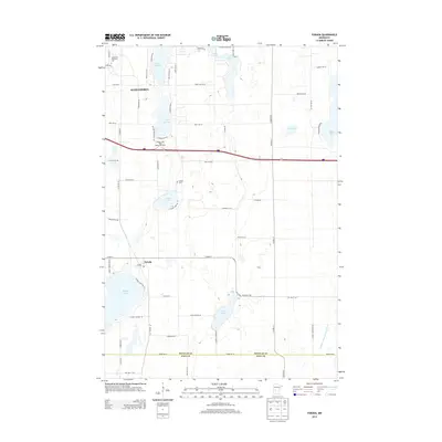
2013 Map of Forada
USGS Topo · Published 2013About this map
Alexandria and Forada anchor this 2013 survey of the lake-strewn landscape in Douglas and Pope counties. The map captures the suburban and educational development at the city's edge, including the campus of Alexandria Technical Coll. The terrain is defined by its glacial hydrology, featuring prominent water bodies such as Maple Lake, Lake Burgan, and the curiously named Lovers Lake. Local history is preserved in features like Hudson Cem and the complex drainage of Judicial Ditch Number Four. The presence of the Burgen Lake West Bound Rest Area along the interstate corridor indicates the area's role as a modern transit hub, while the residential street network around Lake Victoria and Lake Jessie reflects the ongoing transition from rural farmland to lakeside residential communities.
Find a feature on this map
65 named features on this map. Tap any name to fly to it.
Don’t see what you’re looking for? This feature index may not catch every label — zoom into the map to look around manually.
Map Details
Editions of this 2013 Forada Map
This is the sole edition of this map. No revisions or reprints were ever made.
Other maps of this area

1953 · Saint Cloud
USGS Topo · 1:250,000

1957 · Saint Cloud
USGS Topo · 1:250,000

1958 · Saint Cloud
USGS Topo · 1:250,000

1965 · Westport
USGS Topo · 1:24,000

1966 · Alexandria West
USGS Topo · 1:24,000

1966 · Osakis
USGS Topo · 1:24,000

1966 · Lake Osakis West
USGS Topo · 1:24,000

1966 · Lake Mary
USGS Topo · 1:24,000

1966 · Alexandria East
USGS Topo · 1:24,000

1966 · Forada
USGS Topo · 1:24,000