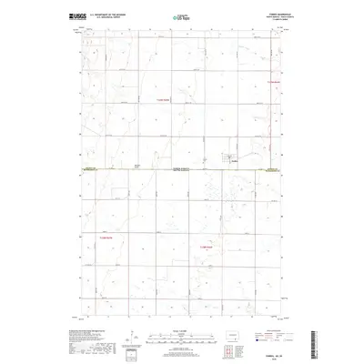
2018 Map of Forbes
USGS Topo · Published 2018About this map
Forbes sits directly on the border of North Dakota and South Dakota, serving as a focal point for the surrounding prairie landscape in 2018. The town's layout is centered on Main St and 3rd Ave, with a local Po serving the community near the junction of Co Hwy 2. This borderland character is reinforced by the presence of the Dickey Co McPherson Co line, which marks the transition between states and jurisdictions.
Find a feature on this map
36 named features on this map. Tap any name to fly to it.
Don’t see what you’re looking for? This feature index may not catch every label — zoom into the map to look around manually.
Map Details
Editions of this 2018 Forbes Map
This is the sole edition of this map. No revisions or reprints were ever made.
Other maps of this area

1894 · Monango
USGS Topo · 1:62,500

1894 · Ellendale
USGS Topo · 1:62,500

1896 · Edgeley
USGS Topo · 1:125,000

1899 · Ellendale
USGS Topo · 1:125,000

1925 · Edgeley
USGS Topo · 1:125,000

1953 · Jamestown
USGS Topo · 1:250,000

1954 · Aberdeen
USGS Topo · 1:250,000

1956 · Aberdeen
USGS Topo · 1:250,000

1956 · Jamestown
USGS Topo · 1:250,000
1968 · Frederick NW
USGS Topo · 1:24,000