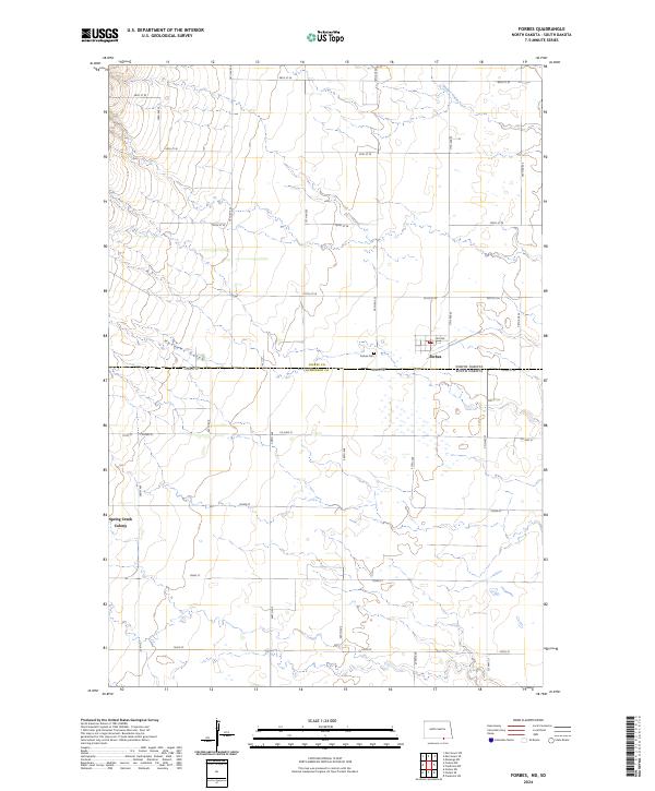
2024 Map of Forbes
USGS Topo · Published 2024About this map
Forbes sits at the very edge of the Great Plains, straddling the state line where the northern reaches of McPherson Co, South Dakota, meet Dickey Co, North Dakota. This prairie landscape is defined by its rectilinear section lines and small-scale agricultural settlements, including the Spring Creek Colony to the west. The terrain is marked by seasonal drainages such as Webber Gulch and Hoevens Gulch, which cut through the open land. Local history is anchored at the Forbes Cem just north of the town site. The map details the local road network connecting these remote communities, including Co Hwy 21 and Co Hwy 23, which serve as vital links across the interstate border. This survey documents the persistent rural character of the region, where land use remains closely tied to the surveyed townships of the Public Land Survey System.
Find a feature on this map
37 named features on this map. Tap any name to fly to it.
Don’t see what you’re looking for? This feature index may not catch every label — zoom into the map to look around manually.
Map Details
Editions of this 2024 Forbes Map
This is the sole edition of this map. No revisions or reprints were ever made.
Other maps of this area

1894 · Monango
USGS Topo · 1:62,500

1894 · Ellendale
USGS Topo · 1:62,500

1896 · Edgeley
USGS Topo · 1:125,000

1899 · Ellendale
USGS Topo · 1:125,000

1925 · Edgeley
USGS Topo · 1:125,000

1953 · Jamestown
USGS Topo · 1:250,000

1954 · Aberdeen
USGS Topo · 1:250,000

1956 · Aberdeen
USGS Topo · 1:250,000

1956 · Jamestown
USGS Topo · 1:250,000
1968 · Frederick NW
USGS Topo · 1:24,000