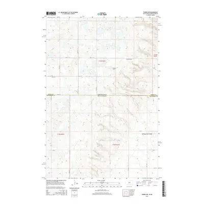
2015 Map of Forbes NW
USGS Topo · Published 2015About this map
Spring Creek Colony anchors the southeastern portion of this map, situated in a landscape defined by the drainage patterns of Webers Gulch and Hoevens Gulch. Straddling the border between Dickey County, North Dakota, and McPherson County, South Dakota, the area represents the transition between the two states along a high-plains plateau. The grid of section roads like 100th St SE and 101st St SE organizes the agricultural terrain, providing access to remote locations such as Saint Peters Cem. This 2015 survey illustrates the enduring patterns of rural land division and settlement in the northern plains, where natural coulees and gulches continue to dictate the placement of roads and homesteads.
Find a feature on this map
19 named features on this map. Tap any name to fly to it.
Don’t see what you’re looking for? This feature index may not catch every label — zoom into the map to look around manually.
Map Details
Editions of this 2015 Forbes NW Map
This is the sole edition of this map. No revisions or reprints were ever made.
Other maps of this area

1896 · Edgeley
USGS Topo · 1:125,000

1899 · Ellendale
USGS Topo · 1:125,000

1925 · Edgeley
USGS Topo · 1:125,000

1953 · Jamestown
USGS Topo · 1:250,000

1954 · Aberdeen
USGS Topo · 1:250,000

1956 · Aberdeen
USGS Topo · 1:250,000

1956 · Jamestown
USGS Topo · 1:250,000

1968 · Long Lake SE
USGS Topo · 1:24,000

1968 · Forbes
USGS Topo · 1:24,000

1968 · Long Lake NE
USGS Topo · 1:24,000
Featured Places
- Lorraine Township, ND
- Albertha Township, ND
- Spring Creek Hutterite Colony, SD
- Dickey County, ND
- McPherson County, SD