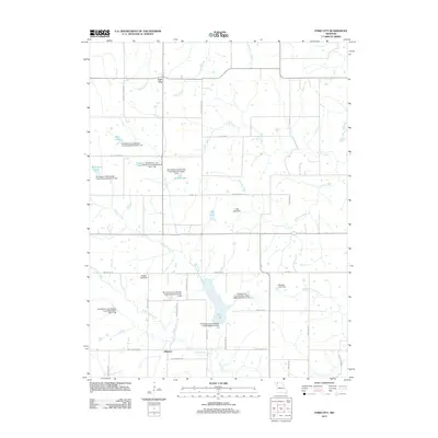
2011 Map of Ford City
USGS Topo · Published 2011About this map
Ford City and the small settlement of Winslow anchor this rural landscape in Gentry and DeKalb Counties. The area is defined by a sophisticated water management network, evidenced by numerous watershed dams such as Grindstone-Lost-Muddy Creek Watershed Dam C-27 and named reservoirs like King Lake. These structures sit along a complex drainage system including Lost Creek, Willow Creek, and Sandy Hook Creek. The map provides a detailed view of the regional road grid, with routes like NW Berlin Rd and NW Winslow Rd connecting isolated farmsteads and agricultural operations like Ellis Farms. This late-twentieth-century development pattern reflects a transition toward intensive land-use and soil conservation efforts in the Missouri heartland, preserving the names of local landmarks like Pate Lake and Waltemath Lake for future generations.
Find a feature on this map
50 named features on this map. Tap any name to fly to it.
Don’t see what you’re looking for? This feature index may not catch every label — zoom into the map to look around manually.
Map Details
Editions of this 2011 Ford City Map
This is the sole edition of this map. No revisions or reprints were ever made.
Other maps of this area

1923 · Clarksdale
USGS Topo · 1:62,500

1923 · Maysville
USGS Topo · 1:62,500

1925 · Clarksdale
USGS Topo · 1:62,500

1925 · Stanberry
USGS Topo · 1:62,500

1925 · Maysville
USGS Topo · 1:62,500

1925 · Darlington
USGS Topo · 1:62,500

1939 · Stanberry
USGS Topo · 1:62,500

1943 · Stanberry
USGS Topo · 1:62,500

1950 · Kansas City
USGS Topo · 1:250,000

1950 · Darlington
USGS Topo · 1:62,500