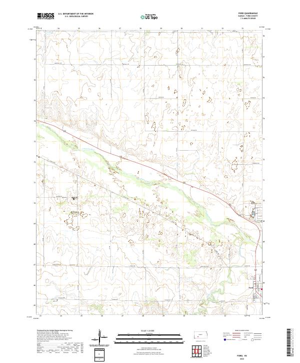
2022 Map of Ford
USGS Topo · Published 2022About this map
Ford serves as the primary settlement on this High Plains landscape, situated near the confluence of the Arkansas River and Mulberry Cr. The town's grid is clearly defined by several named thoroughfares, including Main St, Prairie St, and Walnut St, reflecting a traditional agricultural hub layout. The surrounding terrain is organized by a systematic grid of rural roads, some bearing evocative names like Outlaw Rd, Lariat Way, and Quaker Rd. This survey documents the intersection of modern property boundaries and the enduring natural course of the river, which snakes diagonally across the township lines of T27S R23W and T27S R22W. The landscape outside the immediate river valley is defined by long, straight connectors such as Ford Ensign Rd and Tillman Rd, illustrating the vast scale of land division in Ford County.
Find a feature on this map
23 named features on this map. Tap any name to fly to it.
Don’t see what you’re looking for? This feature index may not catch every label — zoom into the map to look around manually.
Map Details
Editions of this 2022 Ford Map
This is the sole edition of this map. No revisions or reprints were ever made.
Other maps of this area

1892 · Spearville
USGS Topo · 1:125,000

1894 · Spearville
USGS Topo · 1:125,000

1955 · Pratt
USGS Topo · 1:250,000

1959 · Pratt
USGS Topo · 1:250,000
1969 · Fort Dodge SW
USGS Topo · 1:24,000

1969 · Fort Dodge
USGS Topo · 1:24,000

1969 · Bucklin
USGS Topo · 1:24,000

1969 · Kingsdown
USGS Topo · 1:24,000

1969 · Bucklin NW
USGS Topo · 1:24,000

1969 · Ford
USGS Topo · 1:24,000