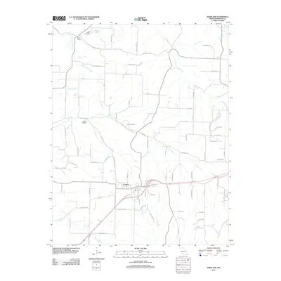
2012 Map of Fordland
USGS Topo · Published 2012About this map
The town of Fordland serves as the central hub of this Webster County landscape, where the transport corridor of U.S. Route 60 cuts through the Ozark plateau. To the north, Totten Lake is held by the FA Totten Lake Dam, while the surrounding terrain is deeply etched by a network of waterways including Panther Creek, North Carolina Creek, and the southern Greasy Creek. Family and community history is anchored by several burial grounds, including the Steward Cemetery located near Burks Hollow, Mount Olive Cemetery to the northwest, and Zion Cemetery in the east. The map reveals a transition from the structured residential streets of the town center to the winding rural routes like Cave Springs Rd, which leads toward the natural feature of Cave Spring. This topography reflects the typical Missouri Ozarks mix of cleared pastureland and wooded drainage branches.
Find a feature on this map
84 named features on this map. Tap any name to fly to it.
Don’t see what you’re looking for? This feature index may not catch every label — zoom into the map to look around manually.
Map Details
Editions of this 2012 Fordland Map
This is the sole edition of this map. No revisions or reprints were ever made.
Other maps of this area

1884 · Springfield
USGS Topo · 1:125,000

1886 · Springfield
USGS Topo · 1:125,000

1937 · Ozark
USGS Topo · 1:48,000

1939 · Fordland
USGS Topo · 1:62,500

1942 · Fordland
USGS Topo · 1:62,500

1943 · Ozark
USGS Topo · 1:62,500

1945 · Ozark
USGS Topo · 1:62,500

1946 · Niangua
USGS Topo · 1:62,500

1947 · Strafford
USGS Topo · 1:62,500

1948 · Niangua
USGS Topo · 1:62,500