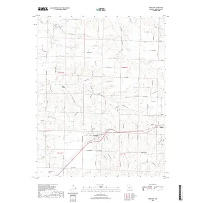
2017 Map of Fordland
USGS Topo · Published 2017About this map
Fordland and the neighboring community of Diggins anchor the high ground in this section of Webster County, situated along the corridor of U.S. Route 60. The landscape is characterized by a complex network of drainages and named hollows, including Meyers Hollow, Burks Hollow, and White Oak Hollow, which feed into local waterways such as Panther Cr and Greasy Cr. This era shows a well-developed network of rural roads, many bearing family and descriptive names like Dutch Hill Rd and S Iron Mountain Rd, tracing the undulating terrain between the forks of the N Fork and Dry Fork. Local history and genealogy are well-preserved through numerous small burial grounds, from the central Fordland Cem to the outlying Mount Olive Cem and Steward Cem, marking early settlement patterns in the Missouri Ozarks.
Find a feature on this map
116 named features on this map. Tap any name to fly to it.
Don’t see what you’re looking for? This feature index may not catch every label — zoom into the map to look around manually.
Map Details
Editions of this 2017 Fordland Map
This is the sole edition of this map. No revisions or reprints were ever made.
Other maps of this area

1884 · Springfield
USGS Topo · 1:125,000

1886 · Springfield
USGS Topo · 1:125,000

1937 · Ozark
USGS Topo · 1:48,000

1939 · Fordland
USGS Topo · 1:62,500

1942 · Fordland
USGS Topo · 1:62,500

1943 · Ozark
USGS Topo · 1:62,500

1945 · Ozark
USGS Topo · 1:62,500

1946 · Niangua
USGS Topo · 1:62,500

1947 · Strafford
USGS Topo · 1:62,500

1948 · Niangua
USGS Topo · 1:62,500