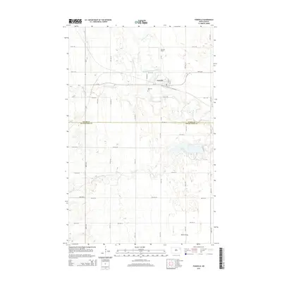
2014 Map of Fordville
USGS Topo · Published 2014About this map
Fordville sits at the center of this North Dakota landscape, where the agricultural grid is defined by a complex network of waterways. The town is bounded by the North Branch Forest River and Middle Br Forest River, which converge to form the Forest River just east of the settlement. The 2014 survey illustrates the region’s reliance on both aviation and land transport, featuring the Fordville Airport and a dense system of county roads and state highways like ND-32. To the south, the terrain descends into Skunk Coulee, a distinct geological break in the otherwise steady plains. For those tracing local history or family ties, Oak Grove Cem provides a specific point of reference just south of the main township. The map also delineates the jurisdictional boundary between Walsh Co and Grand Forks Co, cutting across the southern portion of the quadrangle.
Find a feature on this map
36 named features on this map. Tap any name to fly to it.
Don’t see what you’re looking for? This feature index may not catch every label — zoom into the map to look around manually.
Map Details
Editions of this 2014 Fordville Map
This is the sole edition of this map. No revisions or reprints were ever made.
Other maps of this area

1952 · Thief River Falls
USGS Topo · 1:250,000

1956 · Thief River Falls
USGS Topo · 1:250,000

1957 · Thief River Falls
USGS Topo · 1:250,000

1963 · Orr
USGS Topo · 1:24,000

1963 · Pleasant Valley
USGS Topo · 1:24,000

1963 · Fordville SE
USGS Topo · 1:24,000

1963 · Pisek
USGS Topo · 1:24,000

1963 · Fordville
USGS Topo · 1:24,000
1963 · Inkster
USGS Topo · 1:24,000

1967 · Thief River Falls
USGS Topo · 1:250,000