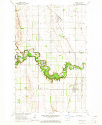
1963 Map of Inkster
USGS Topo · Published 1964About this map
The meandering Forest River serves as the dominant geographic feature of this mid-century survey, cutting through the prairie landscape where Walsh and Grand Forks counties meet. This area reflects a deeply rooted agricultural and communal identity, most notably marked by the Forest River Colony and the small railroad hub of Inkster. The landscape is etched with the transport networks of a bygone era, featuring the intersecting paths of the Soo Line and Great Northern railroads, which facilitated the movement of grain and goods through Conway and the surrounding townships of Eden and Strabane. Local history and genealogy are preserved in the locations of St Marks Cem and the East Forest River Cem, while small-scale industry is evidenced by scattered Gravel Pits and a rural Landing Field.
Find a feature on this map
19 named features on this map. Tap any name to fly to it.
Don’t see what you’re looking for? This feature index may not catch every label — zoom into the map to look around manually.
Map Details
Editions of this 1963 Inkster Map
This is the sole edition of this map. No revisions or reprints were ever made.
Other maps of this area

1952 · Thief River Falls
USGS Topo · 1:250,000

1956 · Thief River Falls
USGS Topo · 1:250,000

1957 · Thief River Falls
USGS Topo · 1:250,000

1963 · Orr
USGS Topo · 1:24,000

1963 · Inkster NE
USGS Topo · 1:24,000

1963 · Pleasant Valley
USGS Topo · 1:24,000

1963 · Fordville SE
USGS Topo · 1:24,000

1963 · Pisek
USGS Topo · 1:24,000

1963 · Veseleyville
USGS Topo · 1:24,000

1963 · Fordville
USGS Topo · 1:24,000