
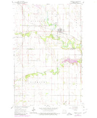
1963 Map of Fordville
USGS Topo · Published 1964About this map
Fordville serves as the central hub for this 1960s agricultural region, situated where the Soo Line tracks intersect the branching waters of the Forest River. The landscape is defined by the convergence of the North Branch Forest River, Middle Branch Forest River, and South Branch Forest River, creating a distinctive riparian network that cuts through the surrounding plains. These drainage patterns influenced the placement of early infrastructure, from the Oak Grove Cem on the town's edge to the Fordville Airport to the north.
Find a feature on this map
16 named features on this map. Tap any name to fly to it.
Don’t see what you’re looking for? This feature index may not catch every label — zoom into the map to look around manually.
Map Details
Editions of this 1963 Fordville Map
2 editions found
Other maps of this area

1952 · Thief River Falls
USGS Topo · 1:250,000

1956 · Thief River Falls
USGS Topo · 1:250,000

1957 · Thief River Falls
USGS Topo · 1:250,000

1963 · Orr
USGS Topo · 1:24,000

1963 · Pleasant Valley
USGS Topo · 1:24,000

1963 · Fordville SE
USGS Topo · 1:24,000

1963 · Pisek
USGS Topo · 1:24,000
1963 · Inkster
USGS Topo · 1:24,000

1967 · Thief River Falls
USGS Topo · 1:250,000
1971 · Fordville SW
USGS Topo · 1:24,000