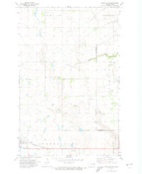
1971 Map of Fordville SW
USGS Topo · Published 1974About this map
Petersburg sits at the southwestern corner of this 1970s landscape, serving as a primary point of settlement along the Burlington Northern railroad. The map documents a predominantly rural expanse divided by the border of Nelson and Grand Forks counties, with townships like Dahlen, Elk Mount, and Nash defining the local geography. Significant water features such as Skunk Coulee and the North Branch Turtle River carve through the plains, influencing the distribution of field lines and roads.
Find a feature on this map
15 named features on this map. Tap any name to fly to it.
Don’t see what you’re looking for? This feature index may not catch every label — zoom into the map to look around manually.
Map Details
Editions of this 1971 Fordville SW Map
This is the sole edition of this map. No revisions or reprints were ever made.
Other maps of this area

1939 · Niagara
USGS Topo · 1:62,500

1942 · McVille
USGS Topo · 1:62,500

1952 · Grand Forks
USGS Topo · 1:250,000

1952 · Thief River Falls
USGS Topo · 1:250,000

1952 · New Rockford
USGS Topo · 1:250,000

1953 · Devils Lake
USGS Topo · 1:250,000

1956 · New Rockford
USGS Topo · 1:250,000

1956 · Thief River Falls
USGS Topo · 1:250,000

1956 · Devils Lake
USGS Topo · 1:250,000

1956 · Grand Forks
USGS Topo · 1:250,000