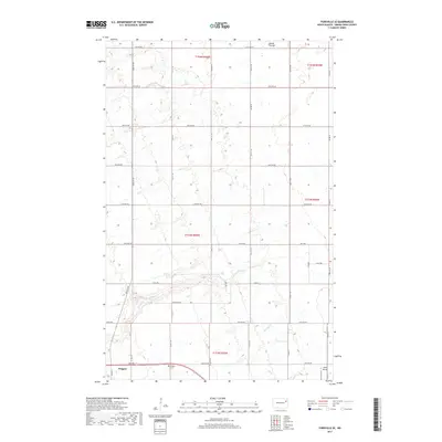
2017 Map of Fordville SE
USGS Topo · Published 2017About this map
Niagara occupies the southwestern corner of this survey area, serving as a primary point of interest in a landscape defined by North Dakota's vast agricultural grid. The town is flanked by the Niagara Cem to its east, providing a point of genealogical record for the local community. Further east, the private Kyllo Airport sits near the boundary of Grand Forks County, illustrating the importance of local aviation in rural transit. The terrain is etched by several watercourses that disrupt the rectilinear road network, including the winding N Br Turtle River, Whisky Cr, and the northern drainage of Skunk Coulee. These features highlight the natural drainage patterns of the Red River Valley’s western edge, where the land begins its gradual ascent toward the drift plain. The map's grid, marked by roads like Co Rd 10 and Co Rd 19, demonstrates the enduring precision of the Public Land Survey System in organizing the prairie.
Find a feature on this map
28 named features on this map. Tap any name to fly to it.
Don’t see what you’re looking for? This feature index may not catch every label — zoom into the map to look around manually.
Map Details
Editions of this 2017 Fordville SE Map
This is the sole edition of this map. No revisions or reprints were ever made.
Other maps of this area

1936 · Larimore
USGS Topo · 1:62,500

1939 · Niagara
USGS Topo · 1:62,500

1952 · Grand Forks
USGS Topo · 1:250,000

1952 · Thief River Falls
USGS Topo · 1:250,000

1956 · Thief River Falls
USGS Topo · 1:250,000

1956 · Grand Forks
USGS Topo · 1:250,000

1957 · Thief River Falls
USGS Topo · 1:250,000

1963 · Orr
USGS Topo · 1:24,000

1963 · Fordville SE
USGS Topo · 1:24,000

1963 · Larimore West
USGS Topo · 1:24,000