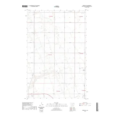
2020 Map of Fordville SE
USGS Topo · Published 2020About this map
Niagara anchors the southwest corner of this section of the Red River Valley, where the prairie is etched by the winding drainages of the N Br Turtle River and Whisky Cr. The landscape is defined by the strict geometry of the Public Land Survey System, with gravel roads like 48th St NE and 26th Ave NE following section lines across the agricultural expanse. In the east, the Elk Valley Lutheran Church Cem stands near the intersection of Bible St and Camp Ave, serving as a local landmark for family historians. A small private landing strip, Kyllo Airport, sits at the southern edge of the sheet, while the northern reaches are marked by the subtle incision of Skunk Coulee. This layout reflects a modern Great Plains township structure where traditional community centers like Niagara Cem remain vital points of reference amidst sprawling farmland.
Find a feature on this map
39 named features on this map. Tap any name to fly to it.
Don’t see what you’re looking for? This feature index may not catch every label — zoom into the map to look around manually.
Map Details
Editions of this 2020 Fordville SE Map
This is the sole edition of this map. No revisions or reprints were ever made.
Other maps of this area

1936 · Larimore
USGS Topo · 1:62,500

1939 · Niagara
USGS Topo · 1:62,500

1952 · Grand Forks
USGS Topo · 1:250,000

1952 · Thief River Falls
USGS Topo · 1:250,000

1956 · Thief River Falls
USGS Topo · 1:250,000

1956 · Grand Forks
USGS Topo · 1:250,000

1957 · Thief River Falls
USGS Topo · 1:250,000

1963 · Orr
USGS Topo · 1:24,000

1963 · Fordville SE
USGS Topo · 1:24,000

1963 · Larimore West
USGS Topo · 1:24,000