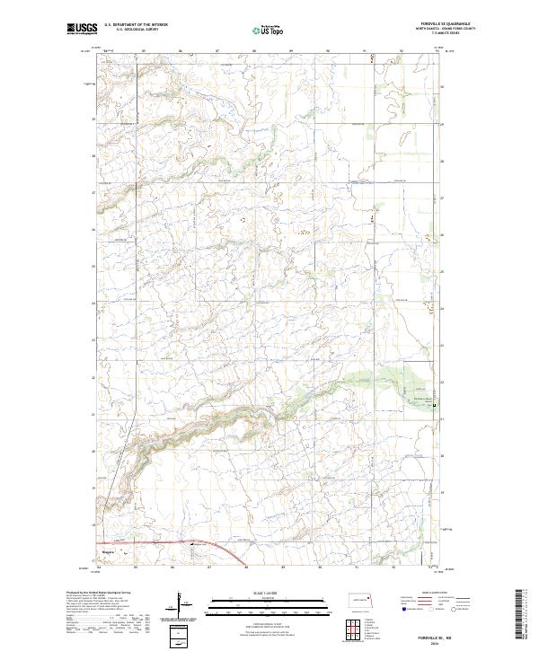
2024 Map of Fordville SE
USGS Topo · Published 2024About this map
Niagara occupies the southwestern corner of this Grand Forks County landscape, serving as a primary settlement point in a region defined by agricultural sections and the winding course of the North Branch Turtle River. The river valley cuts across the southern half of the quadrangle, joined by the curiously named Whisky Creek as it flows eastward. This area maintains a strong rural character, centered around local landmarks such as the Elk Valley Lutheran Church and its associated Elk Valley Lutheran Church Cem on the eastern edge. Genealogists and local historians will find the layout of township boundaries like t152n r56w and t152n r55w particularly useful for locating homesteads and ancestral properties. The map also documents the dense network of rural infrastructure, including Niagara Cem and the section-line roads like Co Rd 10 and 24th Ave that provide access to the vast farmsteads of the Red River Valley hinterlands.
Find a feature on this map
39 named features on this map. Tap any name to fly to it.
Don’t see what you’re looking for? This feature index may not catch every label — zoom into the map to look around manually.
Map Details
Editions of this 2024 Fordville SE Map
This is the sole edition of this map. No revisions or reprints were ever made.
Other maps of this area

1936 · Larimore
USGS Topo · 1:62,500

1939 · Niagara
USGS Topo · 1:62,500

1952 · Grand Forks
USGS Topo · 1:250,000

1952 · Thief River Falls
USGS Topo · 1:250,000

1956 · Thief River Falls
USGS Topo · 1:250,000

1956 · Grand Forks
USGS Topo · 1:250,000

1957 · Thief River Falls
USGS Topo · 1:250,000

1963 · Orr
USGS Topo · 1:24,000

1963 · Fordville SE
USGS Topo · 1:24,000

1963 · Larimore West
USGS Topo · 1:24,000