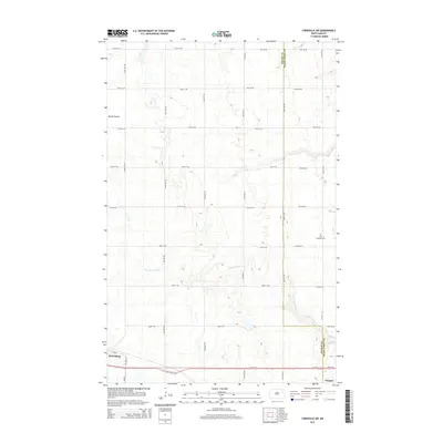
2014 Map of Fordville SW
USGS Topo · Published 2014About this map
Petersburg sits at the southwestern edge of this Red River Valley upland, where the strictly organized section-line road network reveals a landscape dominated by agriculture. The area is defined by subtle drainage patterns, most notably the meandering course of the N Br Turtle River, which cuts through the prairie toward the east. To the northwest, the land drops into the depression of Skunk Coulee, a distinct topographic break in an otherwise uniform terrain of fields and scattered wetlands.
Find a feature on this map
34 named features on this map. Tap any name to fly to it.
Don’t see what you’re looking for? This feature index may not catch every label — zoom into the map to look around manually.
Map Details
Editions of this 2014 Fordville SW Map
This is the sole edition of this map. No revisions or reprints were ever made.
Other maps of this area

1939 · Niagara
USGS Topo · 1:62,500

1942 · McVille
USGS Topo · 1:62,500

1952 · Grand Forks
USGS Topo · 1:250,000

1952 · Thief River Falls
USGS Topo · 1:250,000

1952 · New Rockford
USGS Topo · 1:250,000

1953 · Devils Lake
USGS Topo · 1:250,000

1956 · New Rockford
USGS Topo · 1:250,000

1956 · Thief River Falls
USGS Topo · 1:250,000

1956 · Devils Lake
USGS Topo · 1:250,000

1956 · Grand Forks
USGS Topo · 1:250,000