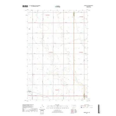
2017 Map of Fordville SW
USGS Topo · Published 2017About this map
Petersburg sits at the western edge of this agricultural landscape in northeastern North Dakota, where the town grid is defined by 1st Ave and 3rd Ave. The terrain is shaped by the winding course of the N Br Turtle River, which meanders through the central and eastern sections of the quadrangle. In the northeast corner, the drainage of Skunk Coulee carves through the prairie, illustrating the subtle but essential water systems of the Red River Valley hinterlands. A strictly rectilinear network of section-line roads, such as 41st ST Ne and 123rd Ave Ne, overlays the land, highlighting the systematic division of the Great Plains. Cultural landmarks are sparse but significant for local history, notably Saint Andrews Cem located near the eastern border toward Niagara. This map captures the intersection of Nelson and Grand Forks counties, documenting the modern rural infrastructure and farmstead patterns of the region.
Find a feature on this map
40 named features on this map. Tap any name to fly to it.
Don’t see what you’re looking for? This feature index may not catch every label — zoom into the map to look around manually.
Map Details
Editions of this 2017 Fordville SW Map
This is the sole edition of this map. No revisions or reprints were ever made.
Other maps of this area

1939 · Niagara
USGS Topo · 1:62,500

1942 · McVille
USGS Topo · 1:62,500

1952 · Grand Forks
USGS Topo · 1:250,000

1952 · Thief River Falls
USGS Topo · 1:250,000

1952 · New Rockford
USGS Topo · 1:250,000

1953 · Devils Lake
USGS Topo · 1:250,000

1956 · New Rockford
USGS Topo · 1:250,000

1956 · Thief River Falls
USGS Topo · 1:250,000

1956 · Devils Lake
USGS Topo · 1:250,000

1956 · Grand Forks
USGS Topo · 1:250,000