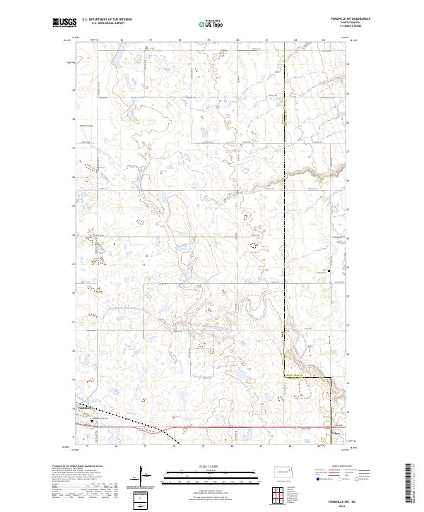
2024 Map of Fordville SW
USGS Topo · Published 2024About this map
The North Branch Turtle River carves a winding path through this portion of the Red River Valley, defining the rural landscape along the border of Nelson and Grand Forks counties. The town of Petersburg sits in the southwestern corner, anchored by the Petersburg City Cem and a grid of local routes like 3rd Ave. To the east, the settlement of Niagara marks the edge of the survey area, connected by the historical alignment of 41st St NE. This modern mapping reflects a classic Midwestern section-line layout, where gravel roads such as 125th Ave NE and 47th St NE organize a landscape primarily used for agriculture and dotted with small water bodies. Notable landmarks include Skunk Coulee in the northwest and Saint Andrews Cem, which serves as a quiet local landmark for families in the region.
Find a feature on this map
40 named features on this map. Tap any name to fly to it.
Don’t see what you’re looking for? This feature index may not catch every label — zoom into the map to look around manually.
Map Details
Editions of this 2024 Fordville SW Map
This is the sole edition of this map. No revisions or reprints were ever made.
Other maps of this area

1939 · Niagara
USGS Topo · 1:62,500

1942 · McVille
USGS Topo · 1:62,500

1952 · Grand Forks
USGS Topo · 1:250,000

1952 · Thief River Falls
USGS Topo · 1:250,000

1952 · New Rockford
USGS Topo · 1:250,000

1953 · Devils Lake
USGS Topo · 1:250,000

1956 · New Rockford
USGS Topo · 1:250,000

1956 · Thief River Falls
USGS Topo · 1:250,000

1956 · Devils Lake
USGS Topo · 1:250,000

1956 · Grand Forks
USGS Topo · 1:250,000