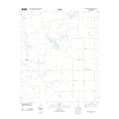
2012 Map of Foreman Chapel
USGS Topo · Published 2012About this map
Foreman Chapel and the Espuela Cem stand as significant landmarks in this Dickens County landscape, reflecting the community’s social and historical fabric. The terrain is defined by a network of drainage systems including Cottonwood Cr, Duck Cr, and Dockum Cr, which feed into numerous managed water bodies. This area features an extensive series of water management projects, prominently labeled as Soil Conservation Service Site 5 Reservoir and Soil Conservation Service Site 10 Reservoir, illustrating the mid-to-late 20th-century emphasis on soil conservation and flood control in West Texas. The infrastructure is primarily composed of ranch-to-market roads and county routes, such as Ranch Road 836 and Farm-To-Market Road 2565, which connect the scattered agricultural holdings. In the southern reach, Hale Lake and Hackberry Draw provide further geographic definition to this cattle-ranching and farming region.
Find a feature on this map
34 named features on this map. Tap any name to fly to it.
Don’t see what you’re looking for? This feature index may not catch every label — zoom into the map to look around manually.
Map Details
Editions of this 2012 Foreman Chapel Map
This is the sole edition of this map. No revisions or reprints were ever made.
Other maps of this area

1954 · Lubbock
USGS Topo · 1:250,000

1961 · Bunker Hill
USGS Topo · 1:24,000

1962 · Smith Tank
USGS Topo · 1:24,000

1966 · McAdoo
USGS Topo · 1:24,000

1967 · Dickens North
USGS Topo · 1:24,000

1967 · Dickens South
USGS Topo · 1:24,000

1967 · Spur
USGS Topo · 1:24,000

1967 · Haystack Mountain
USGS Topo · 1:24,000

1967 · Spur NW
USGS Topo · 1:24,000

1968 · Foreman Chapel
USGS Topo · 1:24,000