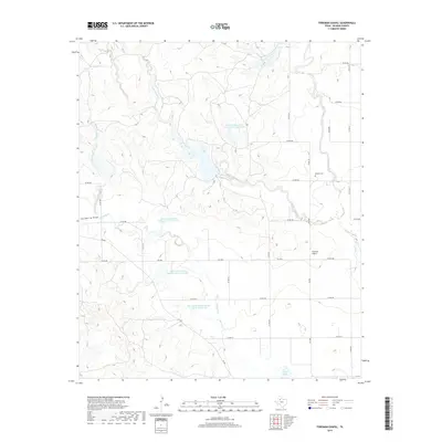
2019 Map of Foreman Chapel
USGS Topo · Published 2019About this map
Foreman Chapel and the nearby Espuela Cem serve as the primary human landmarks in this section of Dickens County, Texas. The landscape is defined by an extensive system of water management, evidenced by numerous man-made catchments such as Soil Conservation Service Site 4 Reservoir and Soil Conservation Service Site 8 Reservoir. These reservoirs are integrated into a network of natural drainages including Cottonwood Creek, Dockum Creek, and Duck Creek. The terrain is further shaped by Hackberry Draw in the west and Hale Lake to the south. A geometric grid of rural roads, such as Co RD 466 and FM 2565, provides access through this ranching and conservation landscape, where the interplay of seasonal creeks and modern infrastructure highlights the area's agricultural reliance on water storage.
Find a feature on this map
24 named features on this map. Tap any name to fly to it.
Don’t see what you’re looking for? This feature index may not catch every label — zoom into the map to look around manually.
Map Details
Editions of this 2019 Foreman Chapel Map
This is the sole edition of this map. No revisions or reprints were ever made.
Other maps of this area

1954 · Lubbock
USGS Topo · 1:250,000

1961 · Bunker Hill
USGS Topo · 1:24,000

1962 · Smith Tank
USGS Topo · 1:24,000

1966 · McAdoo
USGS Topo · 1:24,000

1967 · Dickens North
USGS Topo · 1:24,000

1967 · Dickens South
USGS Topo · 1:24,000

1967 · Spur
USGS Topo · 1:24,000

1967 · Haystack Mountain
USGS Topo · 1:24,000

1967 · Spur NW
USGS Topo · 1:24,000

1968 · Foreman Chapel
USGS Topo · 1:24,000