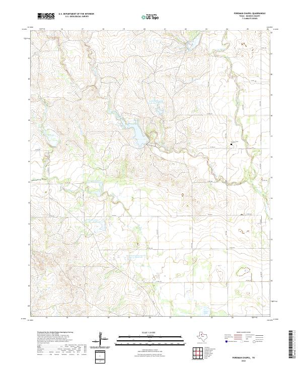
2022 Map of Foreman Chapel
USGS Topo · Published 2022About this map
Espuela Cem serves as a small but significant historical marker in this rural Dickens County landscape, reflecting the long-standing community roots in the area. The terrain is defined by a series of critical water management structures, including the Soil Conservation Service Site 8 Reservoir and Soil Conservation Service Site 9 Reservoir, which are integrated into the drainage patterns of Cottonwood Creek and Dockum Creek. These reservoirs highlight the essential relationship between the local geography and the agricultural necessity of water conservation in the Texas Panhandle. A network of farm-to-market roads and county routes, such as FM 2565 and Co RD 466, provide access across the rolling plains, while natural landmarks like Hackberry Draw and Hale Lake break the regularity of the surveying grid.
Find a feature on this map
32 named features on this map. Tap any name to fly to it.
Don’t see what you’re looking for? This feature index may not catch every label — zoom into the map to look around manually.
Map Details
Editions of this 2022 Foreman Chapel Map
This is the sole edition of this map. No revisions or reprints were ever made.
Other maps of this area

1954 · Lubbock
USGS Topo · 1:250,000

1961 · Bunker Hill
USGS Topo · 1:24,000

1962 · Smith Tank
USGS Topo · 1:24,000

1966 · McAdoo
USGS Topo · 1:24,000

1967 · Dickens North
USGS Topo · 1:24,000

1967 · Dickens South
USGS Topo · 1:24,000

1967 · Spur
USGS Topo · 1:24,000

1967 · Haystack Mountain
USGS Topo · 1:24,000

1967 · Spur NW
USGS Topo · 1:24,000

1968 · Foreman Chapel
USGS Topo · 1:24,000